![]()
| PORTUGUÊS | |
| HOME | |
| ABOUT MOUNT MOCO | |
| CONTACT US | |
| CONSERVATION ISSUES | |
| AFROMONTANE FOREST | |
| TREE PLANTING | |
| PEOPLE | |
| BIRDS | |
| SWIERSTRA'S FRANCOLIN | |
| PLANTS | |
| OTHER ANIMALS | |
| SCENERY | |
| KANJONDE SCHOOL | |
| GETTING THERE | |
| VISITOR INFO | |
| KANJONDE VILLAGE | |
| ABOUT US | |
| LITERATURE | |
| SPONSORS |
Mount Moco is located 10 km from the main Huambo-Lobito road, near the provincial boundary of Huambo and Benguela. The nearest town and administrative centre for most of the region is Ussoque, situated on the main tar road from Huambo to Lobito. Access to Mount Moco is via a narrow 4x4 track, which leaves the main Huambo-Lobito road about 500 m east of Ussoque Town, to the south (turn right when coming from Ussoque). This turn-off is fairly inconspicuous, but is sign-posted to "Fazenda Minho". The track crosses a river over a small wooden bridge, and after a bumpy hour-and-a-half-long drive you should arrive at the village of Kanjonde. The track branches in several places, so you may get a little lost if you don't have a GPS, although there are usually people around who can direct you.
Useful waypoints:
Ussoque Town: 12.353807˚S, 15.101437˚E
Turn off to Kanjonde Village: 12.34961˚S, 15.11049˚E
Kanjonde Village: 12.42822˚S, 15.15258˚E, 1930 m altitude
Click here to download a GPS track (for Garmin GPS) from Ussoque Town to Kanjonde Village
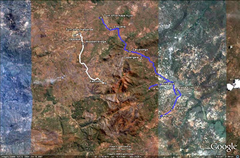
This Google Earth image indicates the two access roads to Mount Moco, one from Ussoque to Kanjonde (in white) and one from Ussoque to Kapa Kuito and Mange in the east (in blue)
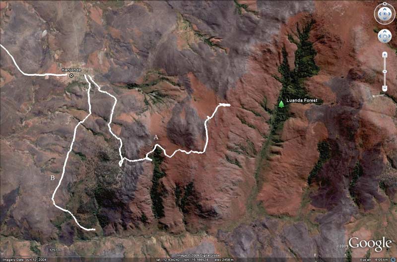
Another Google Earth image of Mount Moco shows 2 different hiking trains from Kanjonde Village.
A: climbs steeply from Kanjonde to the top of the massif, and then towards Luanda Forest
B: following the lower slopes of the mountain south of Kanjonde and then east up the main river valley, to one a great pool for swimming
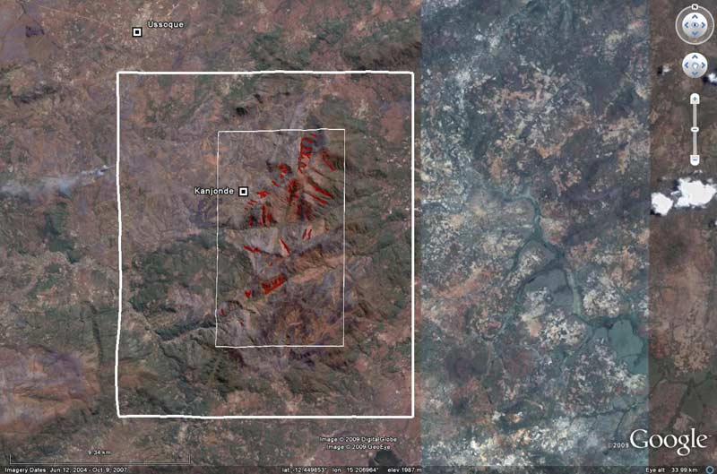
A Google Earth image of Mount Moco the Mount Moco area, with an outline of the proposed Mount Moco Special Reserve. All remaining forest patches are bounded by red.